OlmoEarth v1.3 and Planet-Scale AI Embeddings: The Big Shift Coming to How We Watch the Earth
Most of the AI conversation in the last few years has been about text. Chatbots that write, code that writes itself, search that answers back. But some of the most important AI work happening right now is quieter, and it looks down at the ground from far above. The release of OlmoEarth v1.3, a model built to produce state-of-the-art embeddings for the whole planet, is a good moment to stop and ask what that actually means, and why it may matter more to the average business than another clever chatbot.
The short version: embeddings are the raw material of modern AI. They turn messy real-world data into numbers a computer can compare, sort, and search. When you can do that for the entire surface of the Earth, you unlock a whole category of questions that used to take teams of analysts weeks to answer. That is the promise sitting behind this release.
What "embeddings for the whole planet" actually means
An embedding is a list of numbers that captures the meaning of something. In language models, a word, a sentence, or a document becomes a vector, a point in space. Things with similar meaning land close together. That is how search engines find near-matches and how recommendation systems spot look-alikes.
OlmoEarth v1.3 applies that same idea to the planet. Instead of text, the input is Earth observation data, the kind of imagery and measurements gathered continuously by satellites and sensors. The output is a compact numerical summary of what a patch of land looks like at a given moment: its texture, its color patterns, its structure, its seasonal behavior, all compressed into a reusable vector.
Once you have that, a lot of hard problems become simple comparisons. Is this field the same as it was last month? Does this stretch of coastline look like that stretch of coastline? Which of these ten thousand tiles most resembles the ones where a problem showed up before? The model does the heavy lifting of "understanding" the scene once, and every downstream task can reuse that understanding instead of starting from scratch.
Why "state-of-the-art" is the interesting part
The word that carries the weight here is state-of-the-art. Embedding quality is not a cosmetic detail. A weak embedding smears together things that should be distinct, a parking lot and a bare field, a healthy crop and a stressed one, shallow water and deep water. A strong embedding keeps those distinctions sharp, which means simple, cheap models built on top of it can suddenly perform at a level that used to require large custom systems. When the foundation gets better, everything stacked on it gets better for free.
The bigger trend: from one model per task to one model for the planet
For a long time, geospatial AI worked like a craft workshop. Want to detect ships? Build a ship model. Want to map deforestation? Build a forest model. Want to count buildings? Build another model. Each one needed its own labeled training data, its own tuning, its own maintenance. The result was expensive, slow, and hard to repeat across regions or seasons.
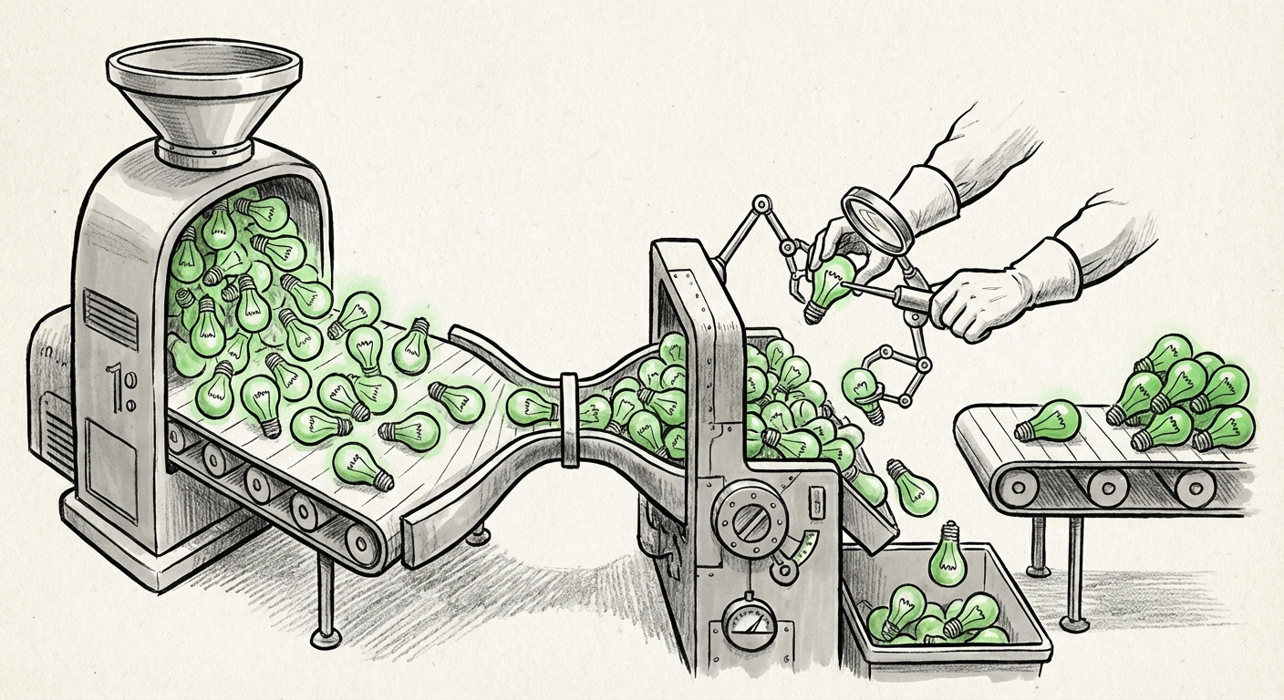
Foundation models flip that pattern. You train one large model on enormous amounts of raw, unlabeled observation data, teach it to represent the world well, and then adapt it to many tasks with far less effort. OlmoEarth v1.3 sits squarely in this shift. It is not a single product for a single job. It is a representation layer, a shared vocabulary for what the surface of the Earth looks like.
This is the same arc that text AI followed. First came task-specific systems, then came general-purpose representations that could be pointed at almost anything. Earth observation is now walking that path, and the consequences for cost, speed, and access are likely to follow a similar curve.
What businesses can actually do with this
Planet-scale embeddings sound abstract until you map them to real decisions. Here is where the practical value shows up.
Agriculture and food supply
Farmers and lenders both care about the same question: how is this land doing? Embeddings make it possible to compare a field against its own history and against similar fields elsewhere, flagging stress, change, or unusual patterns earlier. That supports crop insurance, yield forecasting, and targeted advice, without needing a bespoke model for every crop in every climate.
Insurance and risk
Underwriters price risk based on what has happened to places like a given place. Embeddings turn "places like this one" into a searchable operation. That means faster, more consistent screening for flood exposure, wildfire fuel, coastal change, and land-use shifts, at a scale that manual review cannot match.
Energy, mining, and infrastructure
Large physical assets are spread across enormous areas and change slowly. Embeddings make it cheap to spot the small number of locations that have changed meaningfully, so human attention goes where it is needed. That is as true for a solar farm as it is for a pipeline corridor or a rail network.
Supply chains and logistics
Ports, roads, warehouses, and storage yards all show up in imagery. A good embedding layer lets companies monitor activity and capacity in near-real time across regions where they have no staff on the ground, a genuine edge when conditions shift quickly.
Conservation and public sector
Governments and NGOs face a constant problem: they can see change happening but cannot afford to look everywhere, all the time. A shared embedding model lowers the cost of broad, continuous monitoring, which makes it feasible to watch protected areas, track land conversion, or verify claims about environmental commitments at a scale that was previously out of reach.
What this changes about how AI gets built
The most important implication is not any single application. It is that the reusable layer moves down the stack. When a strong planet-scale embedding exists, a startup no longer needs to train a foundation model to build a useful product. It needs good data about the specific question, a light model on top, and a clear customer. That lowers the barrier to entry dramatically.
It also changes team structure. Instead of hiring a large computer vision group, a company may need one or two people who understand how to use embeddings well, plus domain experts who know what questions are worth asking. The scarce resource shifts from modeling skill to problem selection and ground truth.
And it changes how fast products can move. Prototypes that once took a quarter can now take days, because the representation work is done. That compression of timelines is usually where real market shifts come from, not from a single breakthrough, but from the cost of trying things falling far enough that more people try.
The hard parts nobody should skip
Enthusiasm is warranted, but so is honesty about the limits.
- Embeddings are not answers. A vector tells you what a scene looks like in a form a model can compare. It does not tell you why something changed or whether it matters. Judgment still lives with people.
- Ground truth is still the bottleneck. To turn a representation into a decision, someone has to label real examples. That labeling is expensive and often local.
- Coverage is uneven. The planet is not uniformly observed, and it is not uniformly understood. Places with less historical data will get weaker results, and teams should test for that rather than assume it away.
- Change is constant. Landscapes shift, sensors change, seasons vary. A model that performs well today needs monitoring tomorrow.
- Governance matters. Detailed observation of the Earth raises real questions about privacy, sovereignty, and who gets to see what. These are policy questions, not engineering ones, and they will shape adoption.
Actionable insights for teams watching this space
1. Audit your geospatial questions. Write down every decision your organization makes that depends on what a place looks like. Most companies find more than they expect, from site selection to asset verification.
2. Start with retrieval, not prediction. The fastest win from embeddings is similarity search: find places that look like this one. It needs little labeled data and produces results people can immediately evaluate.
3. Build a small, honest test set. Before investing, label a few hundred examples of the thing you care about. This becomes your measuring stick and saves you from being impressed by demos.
4. Design for model replacement. Keep your data pipeline and evaluation separate from any single model. Embedding models will keep improving, and you want to swap them without rebuilding your product.
5. Pair technical staff with domain experts. The winning teams are not the ones with the biggest models. They are the ones who know exactly which question is worth answering and can tell a good answer from a bad one.
6. Treat compute as a budget line. Running inference over large areas adds up. Plan for sampling strategies, look closely where it matters, broadly where it does not.
The future this points to
If OlmoEarth v1.3 is a sign of where things are heading, the near future looks like this: a small number of strong, general representations of the planet, sitting underneath thousands of specific applications. A shared layer that any team can build on. Monitoring that is continuous rather than occasional. And a shift in the job of the analyst, away from hunting for images, toward interpreting what the images now say automatically.
The deeper point is about access. When understanding the Earth becomes a reusable commodity rather than a bespoke engineering project, the number of people who can act on what they see goes up sharply. That is usually good for competition, good for accountability, and occasionally uncomfortable for anyone who preferred that no one was watching.
Text AI taught us that a strong general representation, once it exists, gets used in ways its creators never imagined. There is little reason to think the planet is different. The interesting question is no longer whether we can build a model that understands the whole Earth in a reusable way. It is what people will do once they can.